Rising Waters: Understanding Nepal’s Seasonal Monsoon Vulnerability
IN BRIEF
Seasonal monsoon weather repeatedly subjects mountain regions to severe flash flooding and landslides. Understanding the interaction between steep topography, intense rainfall, and human settlement highlights why mountain nations remain perpetually exposed to seasonal natural hazards.
Read on for the full picture
Every year, seasonal weather patterns subject South Asia to extreme weather events that cause severe loss of life and massive structural destruction. In regions defined by steep mountainous topography, heavy rainfall quickly transforms into rapid surface run-off, triggering catastrophic landslips and swollen river systems. Understanding how these weather cycles interact with geography explains why mountain nations remain perpetually vulnerable to water-related hazards.
The South Asian monsoon typically arrives between June and September, driven by thermal contrasts between the Indian Ocean and the Asian continent.
Warm, moisture-laden air moves northward from the ocean, encountering the towering barrier of the Himalayan mountain range.
As the air masses are forced upward, they cool and condense, releasing vast volumes of precipitation across mountain slopes and valleys.
While rainfall is vital for regional agriculture, hydro-electric generation, and water supplies, the concentration of precipitation over a short timeframe creates severe hydrological stress.
When high-intensity rainfall saturates the upper soil layers, the structural stability of hillside earth collapses, causing destructive landslides that block roadways, destroy homes, and bury low-lying settlements.
Why Do Landslides Occur?
Mountain environments feature steep slopes, thin soil covers, and complex geological fault lines. Torrential rain destabilises these slopes by increasing soil weight and reducing internal friction. Once the soil reaches saturation point, thousands of tonnes of mud and debris slide down valleys at high velocity, sweeping away infrastructure and severing transport links.
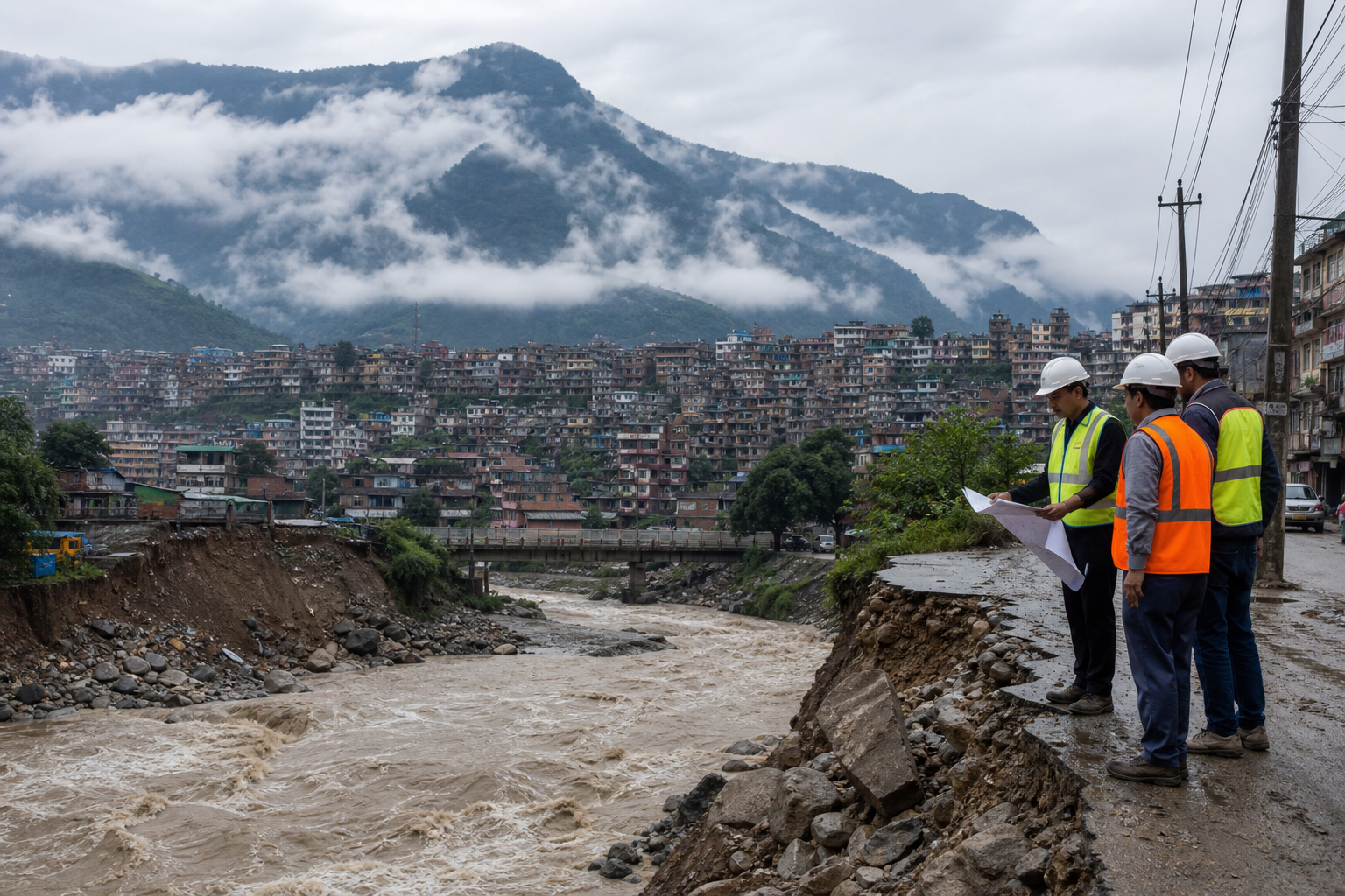
The resulting debris frequently blocks river channels, creating temporary dams. When these natural blockages inevitably fail under hydraulic pressure, they send sudden walls of water downstream. These secondary flash floods often catch communities downstream completely unprepared, expanding the disaster zone far beyond the initial site of rainfall.
In settled river valleys, high river discharge rates cause extensive inundation. Swollen rivers breach their banks, flooding urban centres, agricultural land, and critical public utility infrastructure. The combination of landslips above and rising waters below isolates vulnerable populations, hindering search and rescue operations.
How Does Geography Complicate Rescue?
Disaster response in high-altitude terrain faces severe physical constraints. Landslides frequently cut off key highway corridors, preventing heavy earth-moving equipment and relief supplies from reaching remote mountain districts. Cloud cover and continued turbulent weather often ground aviation units, limiting air transport to sporadic weather windows.
Emergency services must rely on manual clearing operations and local rescue teams while larger national deployment efforts navigate damaged infrastructure. Communications networks and power grids are routinely disrupted, making it difficult for emergency management authorities to establish accurate casualties, track missing persons, or coordinate field logistics.
Search and rescue operations require significant resource mobilization, including specialized medical staff, heavy machinery, and emergency shelter assets. The sheer scale of terrain disrupted by seasonal floods means emergency managers must continually triage responses across dozens of isolated mountain valleys.
What Drives Increasing Risk?
Environmental experts point to a combination of environmental factors and human activity that amplifies monsoon risks across the region. Unplanned urbanization, deforestation on steep slopes, and construction alongside natural drainage channels impair the land's natural ability to absorb heavy rainfall.
Global climate shifts also alter traditional weather patterns, causing precipitation to fall in shorter, far more intense bursts rather than steady, prolonged showers. These high-intensity cloudburst events exceed the natural carrying capacity of regional drainage basins, triggering flash floods with minimal advance warning.
Infrastructure development, including mountain roads constructed without adequate drainage engineering, can further destabilise delicate hillside soil structures. As populations expand into hazardous floodplains and landslide-prone slopes, the overall human and economic exposure to seasonal weather events continues to rise.
What Happens Next?
Regional governments and international agencies continue to invest in early-warning systems, weather radar networks, and community-based disaster preparedness programs. Installing automated river monitoring stations allows downstream authorities to issue evacuation orders before floodwaters arrive.
However, long-term risk reduction requires comprehensive land-use planning, strict building standards on vulnerable slopes, and structural engineering to reinforce critical infrastructure. Until sustainable development strategies are fully integrated with environmental management, high-altitude regions will remain at significant risk during peak seasonal monsoon cycles.