Securing Movement: How Amboseli Monitors Its Elephant Migration Corridors
Conservation teams in the Amboseli ecosystem rely on integrated tracking networks, community rangers, and spatial planning to keep vital elephant migration corridors open and secure.
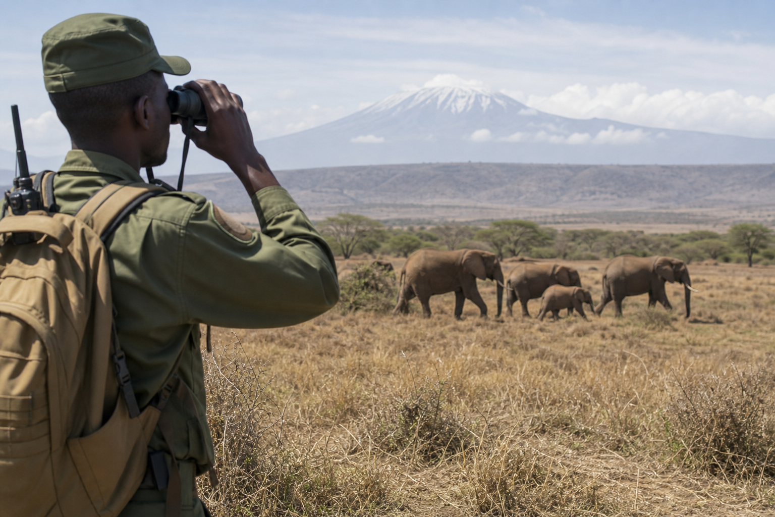
Wildlife protection authorities and local conservation teams in the Amboseli ecosystem rely on a network of community rangers, tracking infrastructure, and aerial surveillance to secure crucial elephant migration pathways. These corridors allow wildlife to move safely between Amboseli National Park, the surrounding group ranches, and neighbouring conservation areas in East Africa.
The Amboseli landscape, which spans the Kenya-Tanzania border, forms a critical habitat for one of Africa's most studied elephant populations. Maintaining open movement routes is vital to preventing human-wildlife conflict and ensuring long-term ecological balance across the region.
Systemic surveillance has come under increased focus following recent security enforcement in the area. Four suspects were arrested over the deaths of 18 elephants in the Amboseli ecosystem, highlighting the continuous operational demands placed on regional monitoring networks.
How Do Corridors Work?
Elephant movement paths in Amboseli link core protected areas to surrounding community conservation lands. These spaces serve as vital conduits for herds searching for seasonal water sources, pasture, and breeding grounds across diverse terrain.
To monitor these vast expanses, conservation management relies heavily on ground patrols conducted by community wildlife rangers. These units operate out of strategic posts, tracking animal movements on foot and using mobile reporting software to record herd locations, habitat degradation, and potential security threats.
Ground operations are augmented by satellite telemetry and GPS tracking collars fitted on key herd leaders. The movement data generated by these devices gives conservation managers real-time visibility into migration patterns, helping teams predict when elephants might enter human settlements or high-risk areas.
What Protects Movement Routes?
Land fragmentation poses a persistent challenge to the Amboseli ecosystem. As farming, infrastructure projects, and human settlements expand, traditional wildlife movement paths risk being blocked, forcing herds into closer contact with local communities.
To secure these routes, conservation partners work with local group ranches to establish dedicated conservancies and spatial land-use plans. By setting aside designated land for wildlife movement, communities receive financial benefits from eco-tourism while keeping vital ecological corridors open.
Aerial surveillance also plays a major role in monitoring large open tracts of land. Light aircraft and unmanned aerial vehicles perform regular reconnaissance flights to assess habitat conditions, spot illegal activity, and guide ground patrols to remote locations that are difficult to reach by road.
What Happens Next?
Conservation authorities and local conservancies are continuing to expand digital tracking tools across the wider ecosystem. Integrating real-time satellite data with ground patrol intelligence remains a priority for improving response times to emerging environmental and security risks.
Efforts to secure legal protections for remaining corridor spaces are also ongoing, with community land boards working alongside national wildlife agencies to integrate wildlife movement pathways into official spatial planning framework documents.